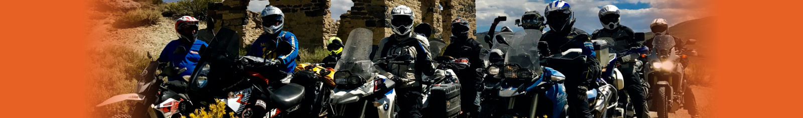
Sierra Nevada Adventures Multi Day Rides
Carrizo-San Andreas Ride 2-Days
 CARRIZO-SAN ANDREAS ADVENTURE RIDE 2-Days
Carrizo-San Andreas ADVENTURE ride EXPLORES an amazing OFF-ROAD route including lonely paved roads with endless curves, and scenic dirt roads along the world-famous San Andreas Fault to the unique geologic feature known as the Carrizo Plain, which is the oldest section along the entire San Andreas Fault zone.
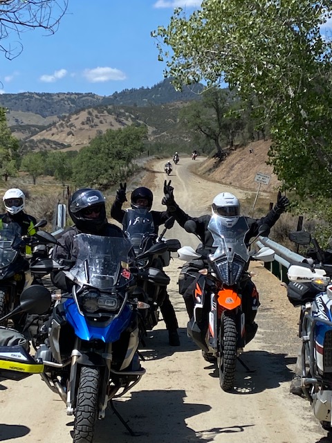
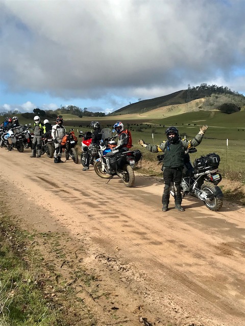
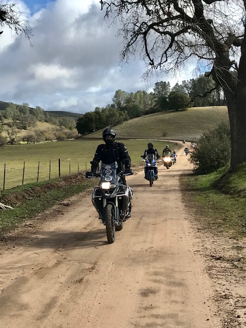
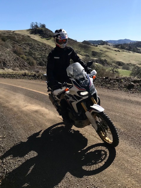
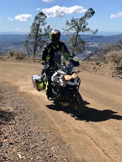
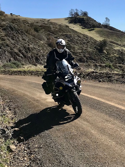
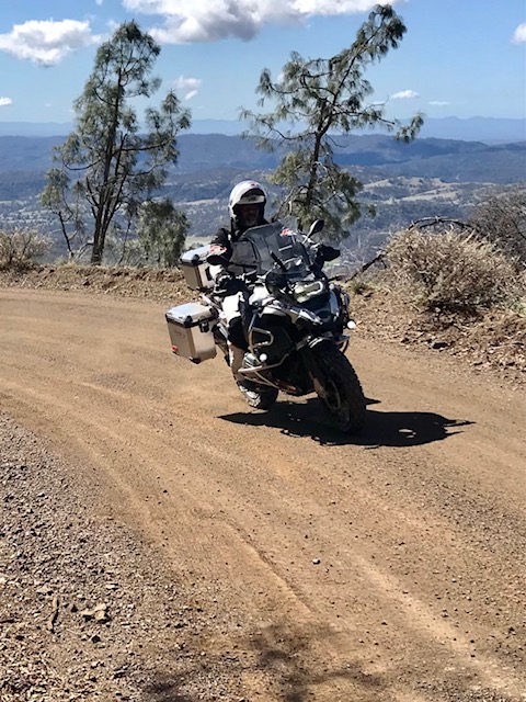
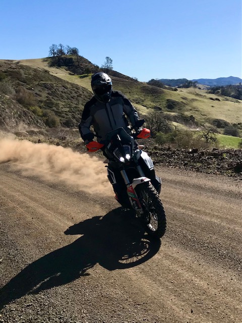
Carrizo-San Andreas Fault Adventure ride is designed for middleweight and heavyweight-size adventure motorcycles with an exciting combination of curvy roads, and single-lane patched paved roads including exciting dirt roads with easy, mild to moderate off-road terrain. On this adventure ride, you will explore an amazing route of lonely roads where you will ride for several hours without seeing another vehicle and more likely see a tumbleweed in the middle of the road, or see an occasional deer, or see a lonely free-range cow standing in the road daring you to pass or see countless suicidal squirrels darting across the road from all directions.
If you've dreamed of an adventure ride full of lonely roads, endless curves, and exciting scenic dirt roads that extend as far as the eye can see. Then the Carrizo-San Andreas Adventure ride is the adventure ride to answer your dreams.
 Your adventure begins in Hollister California which is a renowned location for geologists due to being one of the primary examples of aseismic creep in the world. Hollister is located adjacent to the San Andreas Fault and directly on the Calaveras Fault which runs through the heart of town. The city of Hollister claims to be the "Earthquake Capital of the World."
From Hollister, your adventure travels south along the Calaveras Fault line then before long your route merges with the world-famous San Andreas Fault zone which extends roughly 800 miles northwest through California. The San Andreas Fault forms the tectonic boundary between the Pacific Plate and the North American Plate, and its motion is a right-lateral strike-slip (horizontal) with depths of at least 10 miles into the earth's crust. The entire San Andreas fault system which is a continental transform fault begins in the Pacific Ocean floor south of the tip of Baja then runs north through the Gulf of California or (Sea of Cortez) then extends through the Imperial Valley then veers northwest through the Traverse Mountain Range to the Carrizo Plain then continues northwest to Mussel Rock Beach near the southwest corner of San Francisco in Daly City. At this point the San Andreas Fault plunges into the sea then extends  north along the San Francisco Peninsula to Point Reyes then continues north along the shoreline before extending back into the Pacific Ocean near the Lost Coast in Northern California. From the transition between these two impressive fault lines, your adventure continues south to Pinnacles National Park known for its rich diversity of wildlife, rare talus caves, and unique rock formations. The unique Pinnacles Rocks are part of the ancient Pinnacles-Neenach Volcanic Field that occurred 23 million years ago near present-day Lancaster, in the Antelope Valley of the western Mojave Desert in Southern California, nearly
200 miles southeast. The giant San Andreas Fault split the volcano and the Pacific Plate crept north, carrying the Pinnacles to present-day Pinnacles National Park.
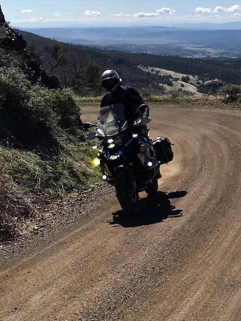
Your off-road adventure begins near Pinnacles National Park where the pavement ends, and your off-road adventure begins on one of the oldest dirt roads in the area that provides scenic views of the Pinnacles and panoramic views of the Salinas Valley below. This off-road route travels past rural ranch land including a historical schoolhouse from the 1800s which is located  adjacent to this scenic route. Beyond the historic schoolhouse, your adventure travels a series of curvy country roads that traverse south along the San Andreas Fault to a remote ridge in the Temblor Range. The name of the range is from the Spanish temblor meaning "tremor", referring to earthquakes from the San Andreas Fault zone that runs parallel to the range.
Your off-road adventure begins once again from the top of the ridge as you descend a curvy dirt road past oaks and shrubs to a small ranch community located in a remote valley along Little Cholame Creek. This small unincorporated community is located directly on the San Andreas Fault in the Temblor Range at an elevation of 1,529 feet. As of 2007, the road sign entering the community announce the population as only 18 people, most of whom are ranchers and farmers. Mining and Homesteading used to be a prosperous activities in this small community, but the mines were exhausted below economic recovery levels and the industry moved elsewhere. There is a small tourism industry in the community based on horse-related events, hunting, a bluegrass music festival, and its unique earthquake history making Parkfield's motto, "Be here when it happens." The big landmark in Parkfield is the bridge over  Little Cholame Creek that carries the Parkfield-Coalinga Road across the San Andreas Fault. Perfectly straight when built in 1936, the bridge has been slowly bending over the decades as the right-lateral fault motion continues. You will have the opportunity to visit this geological site marking the San Andreas Fault and the split between the North American Plate and the Pacific Plate where you can see more than 5 feet of total offset in the bridge's concrete piers that were originally aligned.
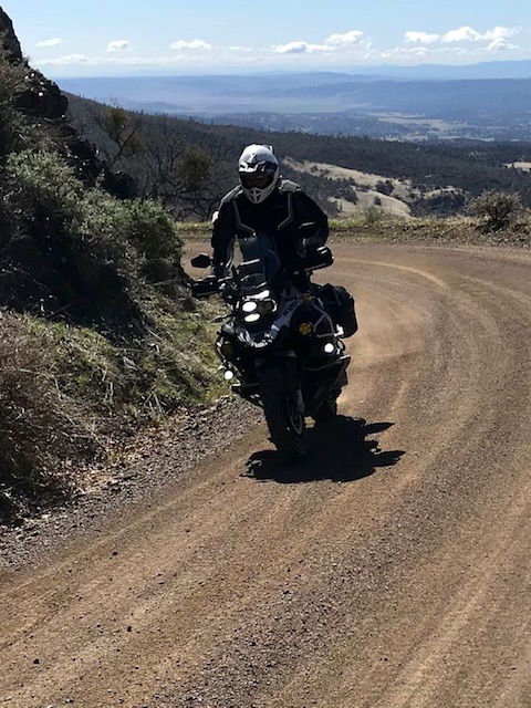
Beyond Parkfield, your adventure continues south on a lonely single-lane patched paved country road through a narrow linear valley carved by the San Andreas Fault which provides visible signs of seismic activity around every corner as you roll through this unique landscape. This lonely country road travels past several abandoned homesteads from a bygone era seemingly trapped in time and taken over by suicidal squires and free-range cattle that roam the countryside. Before long, this narrow valley opens to a vast grassland valley known as the Carrizo Plain that seems to stretch out as far as the eye can see. The unique geologic feature known as the Carrizo Plain is the oldest section along the entire San Andreas Fault zone with a 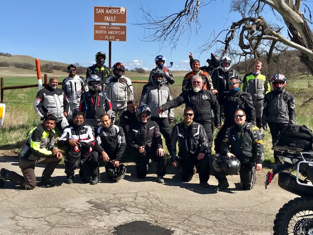 massive geological crack in the earth's crust that parallels the east side of the vast grassland valley.
The Carrizo Plain National Monument is a large, enclosed grassland plain, 50 miles long and up to 15 miles across making it the largest single native grassland valley remaining in California. The Carrizo Plain extends northwest from the town of Maricopa, following the San Andreas Fault. Bordering the plain to the northeast is the Temblor Range, on the other side of which is California's Central Valley. Bordering the plain to the southwest is the Caliente Range. The community of California Valley is in the northern part of the plain stretch north to 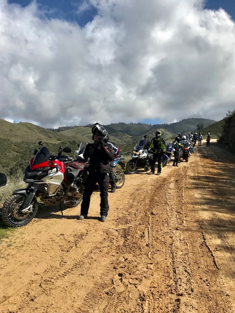 the historic Twisselman Ranch. In the early 1860s, German native Heinrich "Henry" Twisselman and his four brothers arrived at the San Francisco Bay as merchant seamen aboard a Danish whaling ship. After meeting his wife Elizabeth "Lizzie" Meng, a Switzerland native, the couple moved to San Luis Obispo in the late 1870s to establish Chorro Dairy, where Cal Poly State University now sits. Unfortunately, Henry passed away some short six years later of tuberculosis, leaving Lizzie and her five children. In 1884, Lizzie moved to join her family's homestead in the hills above Cholame farming grain and raising livestock, establishing what now remains Twisselman Ranch and making her one of the first pioneers of the California frontier.
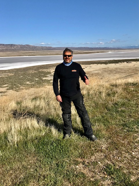
The vast Carrizo Plain valley has an average elevation of about 2,200 feet. Soda Lake, a 3,000-acre alkaline lake, is in the center of the plain with the popular Painted Rock containing Chumash and Yokut rock art nearby. As the central depression in an enclosed basin, Soda Lake receives all the runoff from both sides of the plain. At 5,106 feet, Caliente Mountain, southwest of the plain, stands as the highest point in San Luis Obispo County. The climate type of the Carrizo Plain is semi-arid grassland. No trees grow in the Carrizo Plain and the annual rainfall is 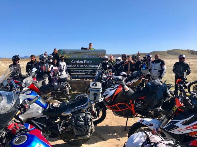 around 9 inches per year.
Carrizo Plain is famous for several geological features, one of them is Wallace Creek which is a small stream draining into Soda Lake, that remains dry most of the year. Wallace Creek drains perpendicular to the San Andreas Fault, and the creek bed is currently offset by 425 ft. due to the movement of the fault. About 23 ft of displacement was created during the 1857 Fort Tejon earthquake. The current segment began forming 3,700 years ago. Sometime between 1540 and 1630 A.D., the creek was offset by about 40.6 feet in an even larger earthquake. The creek has been carefully studied by geologists to find a 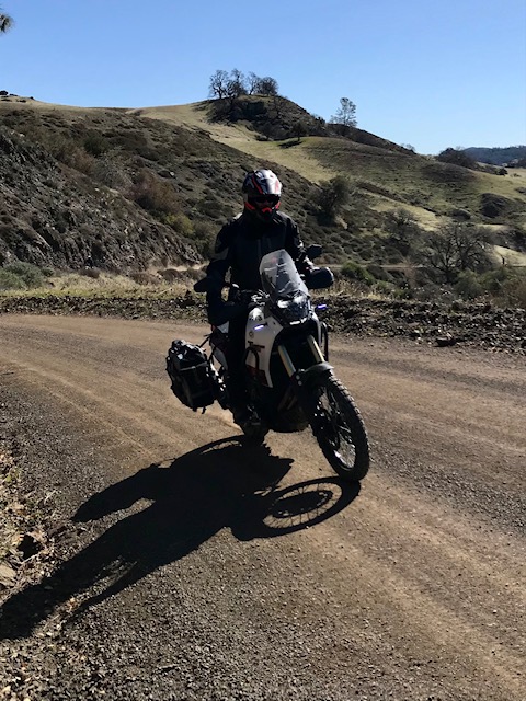 correlation between the offset and historical events, such as earthquakes, that have occurred along the San Andreas Fault. Although Wallace Creek is not the only creek that has been offset by the San Andreas Fault, it is the most spectacular.
Beyond Wallace Creek, you will have the opportunity to venture to the top of Overlook Hill which provides a panoramic view of the Carrizo Plain, the San Andreas Fault, and the shallow Soda Lake that stretches across the landscape. After visiting Overlook Hill your adventure travels south to Painted Rock which is a smooth horseshoe-shaped marine sandstone rock formation with ancient pictograph rock art. The interior of the rock alcove is covered with many impressive pictographs created by Native American Chumash, Salinan, and Yokuts peoples over many thousands of years. Native American people have occupied the Carrizo Plain for at least the last 10,000 years. The Carrizo Plain National Monument lies primarily within the historical territory of the Chumash people. The Salinian, who lived north of the Chumash along the coast to the Salinas Valley, and inland within the Coast Range, also visited the Carrizo, as did the .jpg) Yokuts who lived in the San Joaquin Valley to the east. The presence of pictograph sites like Painted Rock and other Native American spiritual sites on the Carrizo Plain indicate that this region has long held special values to Native American people. Your off-road adventure begins a short distance beyond Painted Rock as you explore south through the wild and scenic Carrizo Plain and the remote corners of the world-famous San Andreas Fault.
Yokuts who lived in the San Joaquin Valley to the east. The presence of pictograph sites like Painted Rock and other Native American spiritual sites on the Carrizo Plain indicate that this region has long held special values to Native American people. Your off-road adventure begins a short distance beyond Painted Rock as you explore south through the wild and scenic Carrizo Plain and the remote corners of the world-famous San Andreas Fault.
Beyond the Carrizo Plain, you arrive in the small oil drilling town of Taft, located in the foothills at the extreme southwestern edge of the San Joaquin Valley. Taft is situated in a major petroleum and natural gas production region in California and is one of the few remaining towns in the United States which exist exclusively because of nearby oil reserves. The discovery of oil known as black gold in the region occurred in the late 19th century near Maricopa, seven miles south of Taft. Many other oil and gas accumulations were discovered around Taft during the early-to-mid-20th century, notably the Midway field (near Fellows, California), Sunset field (later found to be part of the same trend, accounting for the modern combined name of Midway-Sunset), and the Buena Vista. The town is built directly between these two huge oil fields. The operational activities within these fields, as well as California Resources Corporation's Elk Hills Oil Field north of Taft, have been the economic lifeblood of the town for over 100 years. After arriving in Taft, you will have the opportunity to enjoy a cold beer, tasty food, and a warm welcome from the locals and owner of the Black Gold Brewing Company in the heart of Taft California.
Your second-day adventure explores a slightly different route north to Hollister filled with an amazing combination of lonely roads, endless curves, and scenic dirt roads through a unique landscape sculpted by significant geological events created by the world-famous San Andreas Fault.
Event Details:
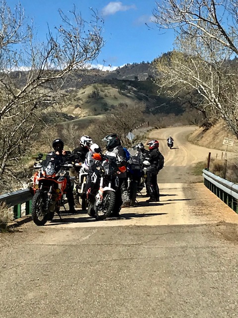
Multi-Day Adventure Ride: (20 rider max)
This adventure ride is designed for (650cc+) to (1250cc+) dual-sport adventure bikes.
Off-road terrain is rated easy, mild, some moderate, and lots of adventure.
Ride distance approx. 475 miles round trip (75+ miles dirt roads)
Gas stops (150-mile range required)
MEETING TIME: 8:30 a.m. (ride starts at 9:00 a.m.)
MEETING LOCATION: Chevron Hollister CA.
Chevron 631 San Felipe Rd, Hollister, CA 95023
Arrive in the morning with a full tank of gas.
Ride returns to Hollister CA. (approx. 5:00 p.m.)
MEALS: (Meals not included)
Breakfast lunch and dinner at restaurants.
Bring water and snacks.
HOTEL RECOMMENDATIONS: (Hotel not included)
Riders are responsible to book their hotel reservations
SATURDAY NIGHT: Taft, CA.
-Best Western, 203 S 6th St, Taft, CA 93268 (661) 745-5555
Additional hotels are available in Taft CA.
OPTIONAL HOTEL Prior to Event: (Hotel not included)
Riders are responsible to book their hotel reservations.
-Sure-Stay Hotel by Best Western 660 San Felipe Rd, Hollister, CA. 95023 (831) 637-9248
Additional hotels are available in Hollister CA.
Truck/trailering your bike? Please make accommodations with your hotel.
OPTIONAL CAMPING (Camping not included)
Recommended to make camping reservations in advance.
Still have questions email: info@SierraNevadaAdventures.com
.jpg)
.jpg)

.jpg)
.jpg)

.jpg)
.jpg)
.jpg)
.jpg)
.jpg)
.jpg)
.jpg)
.jpg)
.jpg)
.jpg)
.jpg)
.jpg)
.jpg)
.jpg)
.jpg)
.jpg)
.jpg)
.jpg)


.jpg)
.jpg)
Still Have Questions?