


Sierra Nevada Adventures Out Of State Rides
Alaska and Canada Adventure 17-Days
We all know adventure is exciting, but true adventure includes risk taking, hazardous action, uncertain outcome and life-changing experiences. I’ve lived my life seeking adventure and I’ve had many opportunities to experience exciting adventures from dirt bike racing to extreme mountain climbing but the one adventure I’ve dreamed about for many years is to have the opportunity to explore the Last Frontier known as Alaska.
We have all seen it before, people around us enjoying their travels, in cars, at the airport and we have even seen dogs sticking their heads out of car windows while passing by. We have also seen people enjoying a variety of off-road excursions but the experience of exploring remote locations by the means of a dual sport motorcycle is perhaps one of the world’s last great adventures. The open air and the freedom of traveling hundreds of miles and exploring unpaved remote locations without the confines of an enclosed vehicle allows the sights, sounds, smells and ever-changing weather to totally immerse the adventure rider into the wonders of the great outdoors. The open air and the freedom of traveling hundreds of miles and exploring unpaved remote locations without the confines of an enclosed vehicle allows the sights, sounds, smells and ever-changing weather to totally immerse the adventure rider into the wonders of the great outdoors.
 After countless hours of research and careful planning our dual sport adventure by Dave Wilson and I, it all came down to the realistic approach by Kevin Sittner to pull the trigger, choose a date and let the adventure unfold. This fly by the seat of your pants approach that we experienced throughout the trip became known as the “Sittner plan”. After a long haul and nearly 1,000-miles we arrived at the border near Vancouver Canada. With one leg over the saddle and the flick of a switch our bikes came to life and we roared off with excitement and uncertainty of how and when the “Sittner Plan” would take effect and turn a well planned trip into an adventure. Our KTM 990 Adventures roared into Canada, as the sights, sounds and smell of rain filled our noses, and the excitement for the days ahead swirled through our thoughts. As each mile past, our dream was unfolding before our eyes as we peered into the horizon with anticipation, waiting to catch as much of the excitement as possible. It’s safe to say, we know why dogs stick their heads out of car windows. Little did we know the vast beauty, intense weather, and grit of the road ahead would transform our plans into a 17 day, 7,000-mile motorcycle adventure of a lifetime.
 Our adventure began as we traveled north with the goal to reach Golden, Canada before night fall. We were soon faced with a challenge as the rainy weather created a landslide closing the main road, while a sense of unplanned adventure began to take hold. After a quick stop to review the map and reset the GPS, our adventure continued with a crossing of the Fraser River and the goal to reach Golden before night fall. Traveling the northern bank of the Fraser River provided breath taking views of the huge river around every corner while the rain continued to increase with every mile and the hopes of reaching our goal before night fall began to fade away. After riding over 400-miles in the rain we arrived late into the night to find the small town of Golden completely dark due to a blackout caused by the stormy weather. After circling the town we were lucky to find a local gas station that was powered up by means of a generator which allowed us to refuel and discuss if we were going to camp or find shelter. During our discussion the rain changed to a light snow flurry which helped with our decision to find shelter in a local motel and we called it a night.
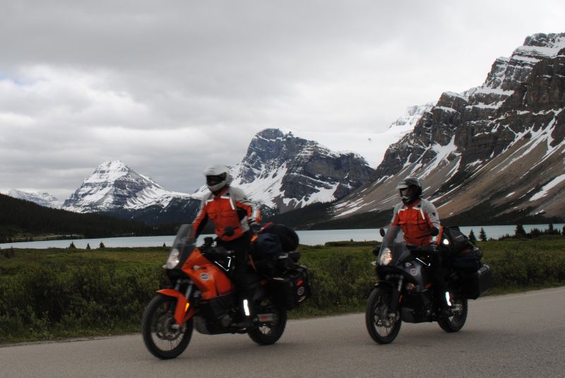
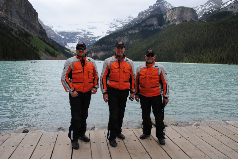
 We woke to partly sunny skies and the sight of the Canadian Rockies. The scenery and striking glacial carved peaks seemed to get more impressive around every corner. Before long we arrived at the beautiful sight of Lake Louise in Banff National Park. Canada’s oldest national park was established in 1885 in the spectacular Rocky Mountains west of Calgary in the province of Alberta, Canada. The beautiful emerald green water, striking mountains and overhanging glacier makes Lake Louise one of the most-famous lakes in the Canadian Rockies. After our visit at Lake Louise we continued north on the scenic Ice-fields Parkway which extends north from Lake Louise to Jasper National Park. The stunning scenery kept our attention and our helmet communication systems on as we rode north with the constant comments from each of us, such as “wow, did you see that? These mountains and lakes are amazing! Check-out that glacier and hey, turn around there’s a bear on the side of the road”. Needless to say, we had an incredible day despite the rain. Traveling on, the sight of another emerald green lake and the stunning mountains grabbed our attention as we veered off the road to get a closer look. As we approach the vista, Dave suddenly lost his balance and dropped his fully loaded bike and completely crushed the hand-guard on the left side of his shiny orange KTM 990 Adventure.
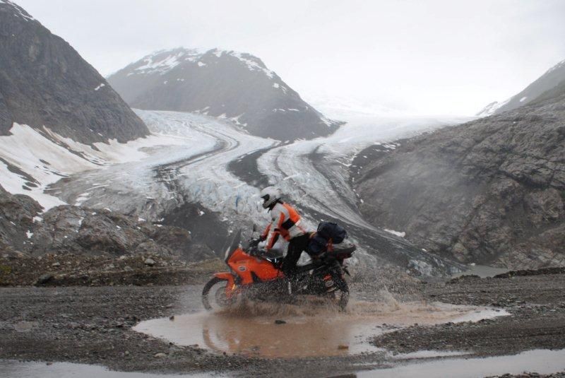 The opportunity to see Dave’s bike flat on the ground is a rare sight so, Kevin and I scrambled to grab our cameras but Dave knew this was a photo opportunity and quickly lifted his bike up to avoid being caught on film. Dave was so quick at recovering from this drop that I was only able to capture a photo of Dave staring at the broken parts scattered on the ground. I restrained myself from having fun at Dave’s expense because I knew we were only a few days into our adventure and there where many more opportunities for one of us to have a mishap. Continuing on we experienced more spectacular scenery and wildlife sightings from black bears to mountain goats and eventually found a dirt road to explore which soon became another mishap and photo opportunity. Once again I was amazed to find Dave’s bike flat on the ground but this time unfortunately for Dave I had my camera in hand and was able to capture photos before Dave could lift his bike. Mishaps are good opportunities for friends to harass each other and this was definitely one of those opportunities. Sorry Dave, but it’s like you always say, “it’s just another ride until something goes wrong and it turns into an adventure”. Eventually we reached the small mountain town of Jasper where we stopped for dinner and found out from the locals that the town of Jasper was going to celebrate Canada Day with a fireworks show. We also found out the local party was going to be held on the tramway viewing deck which overlooks the town. After dinner we rode up the mountain and joined our new found Canadian friends on the tramway viewing deck for a few cold Canadian lagers and celebration of Canada Day eh!.
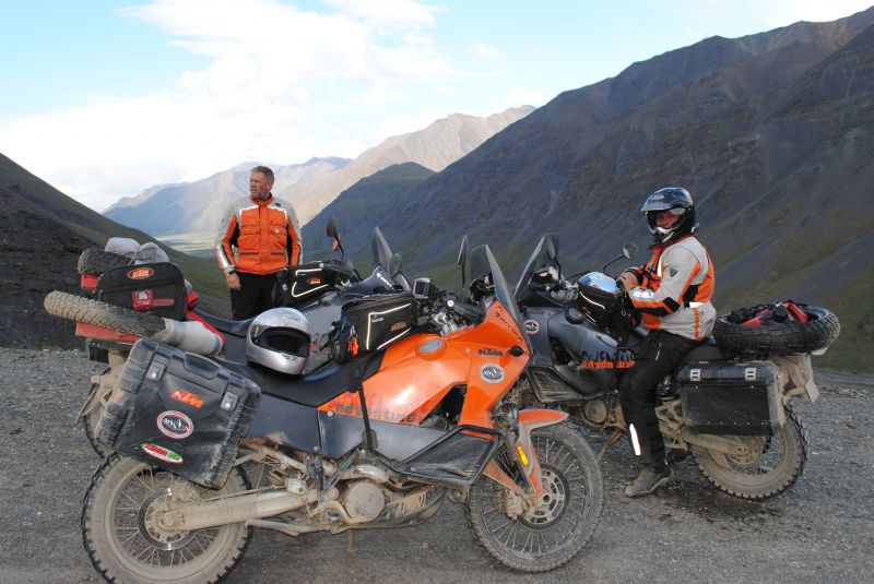
 Our morning started off a little rocky in the Rockies after I discovered the front wheel bearings were going out on my bike. Lucky for us we met a local Canadian who helped locate a set of wheel bearings. The only tricky part was I needed to ride 250-miles on a bad set of wheel bearings. Dave was quick to remind me that it’s just another ride until something goes wrong and then it’s an adventure. With fingers crossed we roared out of town and headed towards Prince George. Traveling on the Yellowhead Hwy we were awestruck at the sight of the impressive Mount Robson which is the highest mountain in the Canadian Rockies. The sight of Mount Robson demanded our attention and we made time to take a break and visit the impressive mountain and the emerald green Robson River. After visiting Mount Robson our adventure continued and I’m happy to say we arrived in Prince George without further mishaps. While making the repairs we were notified by the locals that the road to Dawson Creek was closed due to flooding and the road would be closed for the next two weeks. Faced with a challenge we decided to review the map and adjust our plans to continue northwest towards the remote town of Stewart and Hyder Alaska.
 The day began with a light drizzle but after breakfast the rain had stopped and patches of blue sky began to break through the clouds. Traveling on, we encountered the rare opportunity to take a break while the sun was shining at a scenic overlook. Our break was well deserved after spending the better half of the past three days in stormy weather so we spent a considerable amount of time at Morice Canyon before continuing on. Shortly after our break we encountered our first moose sighting along the hwy and we also viewed a half dozen black bear sightings by the time we reached the junction. Heading north on the Stewart-Cassiar Hwy our sunny weather soon faded away as a misty rain began to take over for the second half of our journey. We veered west at junction 37A and headed towards the small border towns of Stewart and Hyder. Highway 37A better known as the Glacier Highway is a 40-mile spur west of the junction and one of the most scenic paved roads imaginable. The Glacier Highway slices through a narrow canyon with cascading waterfalls around every corner and many impressive glaciers such as the Bear Glacier which terminates at the bottom of the narrow canyon. After exploring the spectacular Glacier Highway we reached the small town of Stewart which is nestled at the head of the Portland Canal, a 90-mile long fjord which forms a natural border between Canada and Alaska.
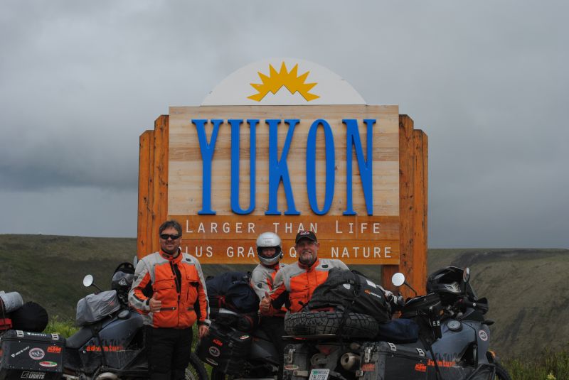 After arriving in Stewart we realized we were only few miles away from reaching Alaska so, our journey continued on in search of cold spirits in the town of Hyder. Before entering Alaska we were warned by the Canadian Border Patrol to be careful in Hyder which he explained is a lawless town running-a-muk, with no law enforcement, no border patrol and the type of town you could buy a gun at a yard sale. Well, after being pre-warned by the friendly Canadian we proceeded on and found the cold spirits we were looking for at the local Pub which is located at mile zero, of the Alaska Yukon Highway.
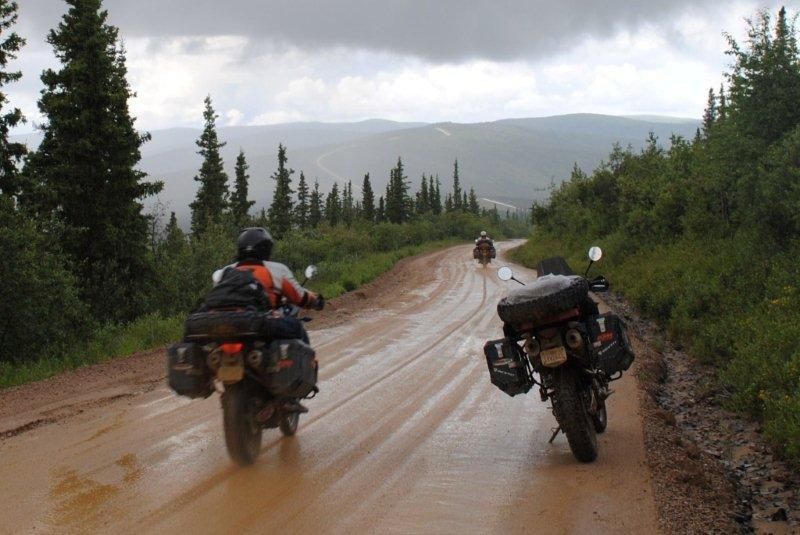
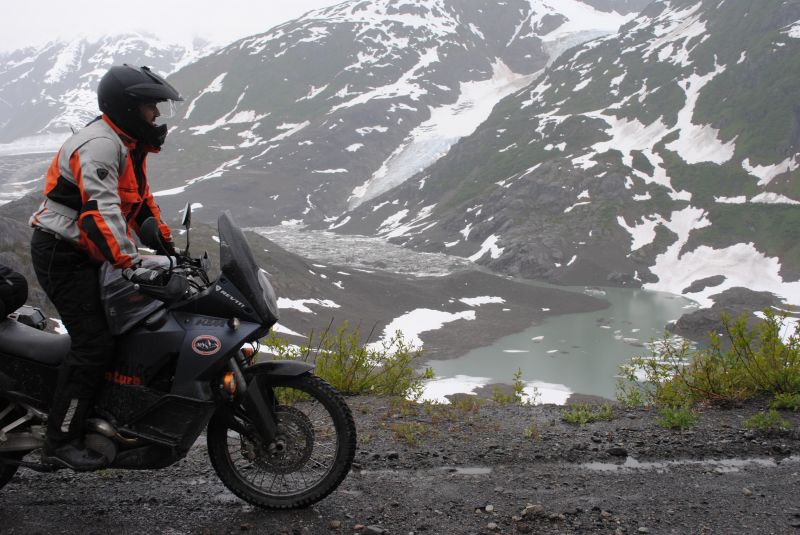
Our day began on the Main Street of Stewart and our adventure began where the pavement came to an abrupt end at the border crossing as we entered into the lawless town of Hyder. The rain had stopped as we traveled through the muddy main street but the smell of rain and the sight of lingering storm clouds filled the sky as the sense of adventure overwhelmed our thoughts in our pursuit to explore the Salmon Glacier.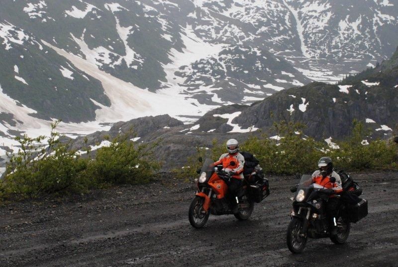 A short distance beyond the edge of town in a swampy meadow we noticed the distinctive sight of a beaver lodge at the base of a solo pine tree which became the first of many scenic stops throughout our day of adventure. A few miles past the beaver lodge is the Fish Creek observation deck, where, from July to September, the Salmon run provides an extensive food supply for bears, gulls and bald eagles. The Fish Creek observation deck also provides a unique opportunity to view and photograph grizzlies and black bears. Unfortunately for us we were approximately one week ahead of the Salmon run so, we were unable to observe the bears feeding in Fish Creek. After visiting Fish Creek our journey continued on up the narrow dirt road which passed by several cascading streams and several gold mines which have been operating since the 1920’s. Further on up the narrow dirt road our view suddenly opened up to an amazing sight of the Salmon Glacier, where the glacier made a gentle “S” curve down between the mountains then seemed to go on forever around the upper mountain and out of sight. We stopped at this point and walked over to the edge to get a closer look and noticed a beautiful sight hundreds of feet below where the emerald green Salmon River was pouring out from an ice tunnel at the base of the glacier. Traveling on, our challenge was trying to keep one eye on the dirt road and one eye on the spectacular view of the Salmon Glacier as it seemed to unveil itself before our eyes.
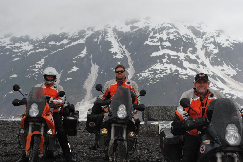 As we reached the vista point, I noticed an elderly gentlemen standing in his raincoat and hat near a display filled with post cards and videos of the Salmon Glacier and wildlife from the surrounding area. I couldn’t help but notice that this gentleman was not only standing in the rain as if it was just another day but he was also standing in the most remote area I’ve ever seen anyone trying to sell anything. I knew this couldn’t be your average gentleman so I introduced myself to find out what his story was all about. Well, I soon found out that my guess was right and this was definitely not your average gentleman, I was talking to Keith Scott, a true mountain man that has devoted his life to exploring and studying black bears and grizzly bears in the Salmon Glacier area. I also found out later in the day, by the locals that this very interesting mountain man is better known as the “Bear Man”. The Salmon Glacier area is all new to me but back at home, I have spent the better half of my life exploring and mountain climbing in the Sierra Nevada and I could understand his passion and I could also feel the passion in every soft spoken word Keith had to say. Keith was not only soft spoken but also modest unless you asked him questions about the Salmon Glacier and questions about the bears seemed to make his eyes light up. Keith’s passion for the bears and wealth of knowledge of the Salmon Glacier was very impressive to say the least. I could have spent the rest of the day standing in the rain talking to Keith and hearing about his adventures but we needed to move on so, after buying a few post cards we said our goodbyes.
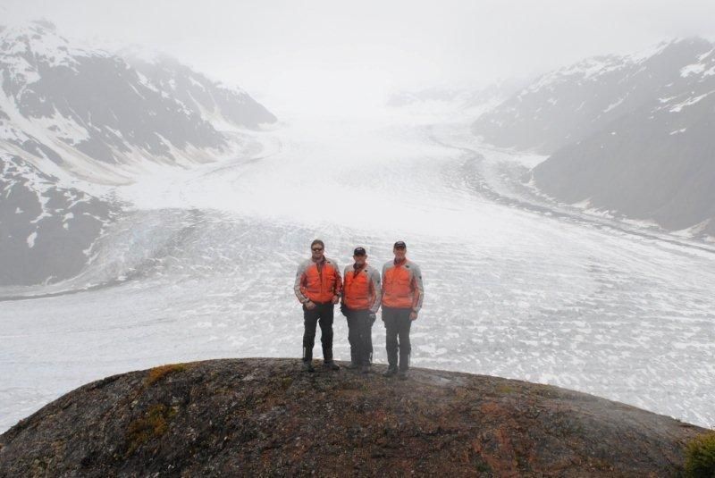 I had just put my helmet on and was ready to ride off when Keith came over and tapped me on the shoulder to say, “There’s a grizzly bear on the glacier”. We quickly took our helmets off and made our way over to the edge of the cliff where down below was not only our first grizzly bear sighting but it was a huge grizzly bear. The bear was at a safe distance down below and had no concern about us as he made his way across the glacier. Keith explained to us that the grizzly was on its way down to the Salmon run and it would take the grizzly about five days to reach Fish Creek. After the excitement from our first grizzly bear sighting we once again said goodbye to Keith and continued on to explore the Granduc Mine. Arriving at the mine in the rain we couldn’t help but notice the harsh landscape and the thought of how difficult it would be to mine this area especially during winter conditions.
After exploring Hyder, Alaska we had no choice but to head north without backtracking into Canada. Hyder is isolated at the southeastern tip of Alaska with no roads heading north so, with no time to waste we ventured back into Canada. Traveling north on the Stewart-Cassair Hwy we encounter an unplanned adventure as Dave’s bike began to sputter and eventually stopped running. We suddenly found ourselves stranded in the middle of nowhere as the relentless rain continued on. Lucky for us we found an abandoned work shed which provided shelter from the rain.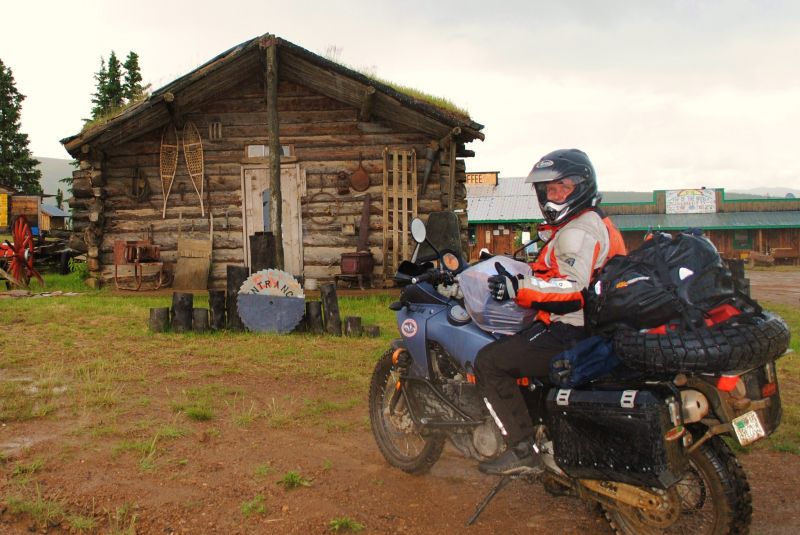 Kevin and I decided to clear debris from the shed as we felt this was going to be our home for the night but before long Dave had diagnosed the problem which was a loose wire and we were back on the road. After traveling for three days in the rain and nearly 1,000-miles we arrived in the historic gold rush town of Dawson City. The town-site is located in a remote area at the confluence of the Klondike River and Yukon River now a national historic site of Canada. The Klondike Gold Rush began in 1896 and changed the small camp into a thriving city of 40,000 by 1898. By the turn of the century the gold rush had ended but left behind one of the most scenic and well preserved gold rush towns in the nation. Our first mission was to get out of the rain and find cold spirits in the historic Downtown Hotel which is home to the world famous Sour-Toe Cocktail. As the story goes, two brothers were rum runners during the 1920’s. While traveling from Canada during a blizzard to deliver booze to the U.S., one brother got frostbite and eventually lost his toe. Somehow it was decided that it should become part of a drink and the tradition lives on.
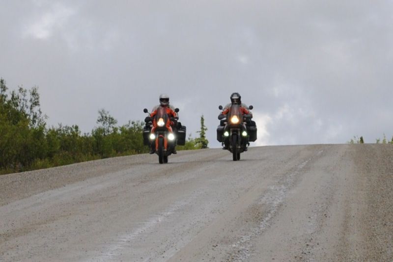
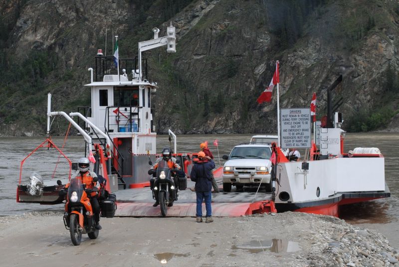 Our journey began as we rode up the steel ramp and boarded the ferry boat crossing of the Yukon River. Once across the river our off-road adventure began on the famous Top of the World Highway. It only takes a few miles of climbing out of Dawson City to realize where the name of this scenic road comes from. The great views start just a few miles beyond the river as the road wanders around the high points of a series of ridges far above tree-line, and the views go on forever. Traveling was a challenge as we tried to keep one eye on the road and one eye on the spectacular scenery. The Top of the World Highway is one of the off-road adventures where experience riding on narrow mountain roads makes a difference between a memorable journey and one that is memorable for mishaps. After 100-miles of riding we reached Poker Creek Alaska which is in the middle of the mountains and the most remote border crossing of our adventure. Leaving the border crossing behind we cut loose and turned it up a notch and rode as if there was no tomorrow while the relentless rain continued on. Nearly 100-miles of hair raising speeds and countless close calls from dodging pot holes and mud holes, we reached the remote mining camp known as Chicken Alaska. Nearing midnight, some 500-miles north of Chicken on the outskirts of Fairbanks we arrived at the Howling Dog Saloon which is the furthest north rock & roll bar in Alaska.
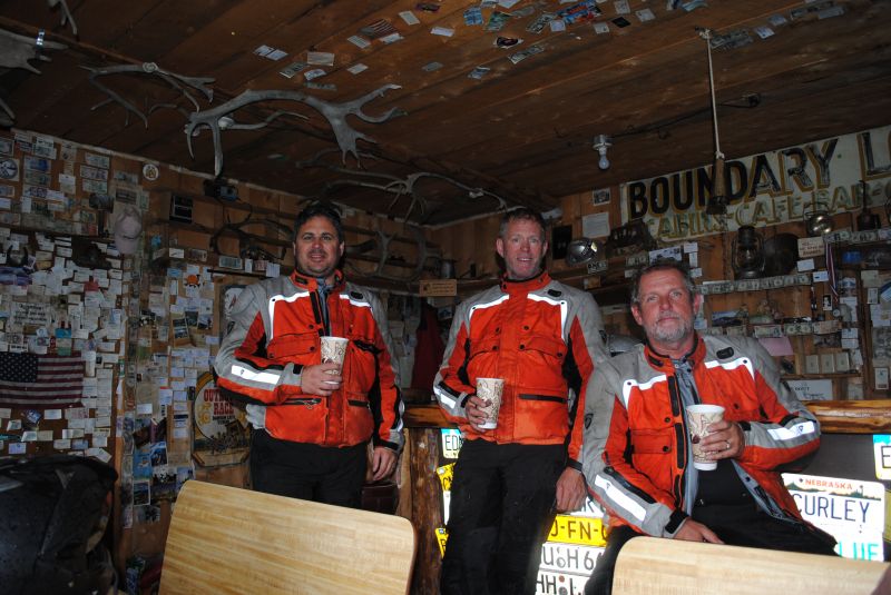 We were welcomed in by the saloon owner Ralph and his friendly bar tender known as Lollypop, who was quick to pour us a round of their finest local brew. This was greatly appreciated after one of our most memorable days of pure adventure. Our new found friends kept the brew flowing as we discussed our plans for the next day. The big dilemma was deciding if we had the extra time on our schedule to ride beyond the Arctic Circle to Deadhorse at Prudhoe Bay. Due to weather conditions and unplanned road closures we were already one day behind schedule and the additional day required to reach Prudhoe Bay would bust Dave’s schedule to return to work on time. Kevin and I did our best to convince Dave that life is too short to be within 500-miles of the furthest northern road in America and not complete our goal. Unfortunately all our talk and cold brew could not convince Dave to go all the way to Prudhoe Bay. Ralph announced to Lollypop that it was time for the last round so, she poured us a fresh pint of cold brew and we called it a night.
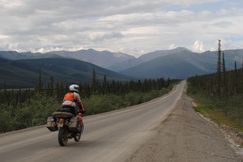 The morning after our night at the Howling Dog Saloon started off slow but before long we were back on the road with the wind in our face. The sky was cool and crisp but the rain had stopped so, we were excited about the possibility of having good weather on our journey to the Arctic Circle. Nearly 100-miles north from our starting point we reached mile zero of the Dalton Highway better known as the world famous Ice Road Truckers Route. Perhaps no other road system in Alaska captures the true pioneer spirit of the Last Frontier as does the 414-mile Dalton Highway. The famous highway is named after James Dalton, an Arctic engineer involved in early oil exploration on the North Slope of Alaska. It was built as a haul road between the Yukon River and Prudhoe Bay during construction of the Trans-Alaska Pipeline, and was originally called the North Slope Haul Road. Construction on the road began April 29, 1974, and was completed 5 months later. The road is a mix of dirt and gravel with a calcium chloride coating with some sections of the road that are underlain with plastic foam insulation to prevent thawing of permafrost beneath it. The 414-mile dirt and gravel road travels through some of the wildest, remote and scenic land in Alaska, that includes stunted conifer forest, rivers, tundra and the majestic Brooks Range; as well as passing along the man-made Trans-Alaska Pipeline.
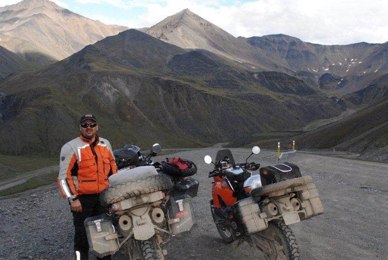 Although the Dalton is a must do for true adventure, this unpaved road is not the road for the faint of heart, or for those with a new vehicle. It is still the main supply route for the Prudhoe Bay oilfields, and you will be sharing the road with large trucks traveling at high speeds and kicking up clouds of dust or mud while reducing visibility to absolute zero. Windshields, headlights and body parts are easy targets for flying rocks. Don’t even consider traveling the Dalton unless you have off-road tires, extra fuel, food and enough supplies to survive in extremely remote grizzly country.
Traveling into the wild, our first major milestone was crossing a wood plank bridge over the mighty Yukon River, including our first and only fuel stop since we left the Howling Dog Saloon.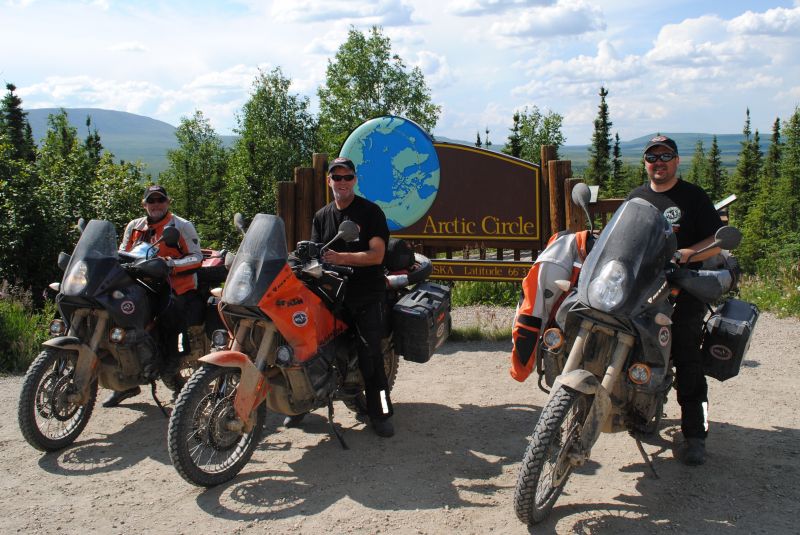 Continuing on we eventually reached the Arctic Circle where we stopped for a photo shoot at the remote monument sign that marks the latitude of the Arctic Circle. Once off our bikes, it didn’t take long for our conversation to start back up between Kevin and I about the idea of continuing on to Prudhoe Bay but Dave didn’t want to hear it. Kevin and I pleaded our reasoning to Dave and explained once again that life is too short and we may never have the opportunity to explore the Dalton to Prudhoe Bay but once again Dave wanted nothing to do with our shenanigans. Dave was adamant that we needed to stick to the well planned trip or he wouldn’t be able to return to work as scheduled. After a heated discussion, Kevin and I stopped trying to convince Dave to head north and agreed to stick to his schedule and tried to enjoy our visit at the Arctic Circle. After visiting the Arctic Circle, it was time to head south back to the Howling Dog Saloon. As we were leaving the monument sign, Kevin suddenly turned north towards Prudhoe Bay, at that moment I knew the “Sittner Plan” was in full throttle. Without hesitation I turned north and followed suit, as Dave remained idle.
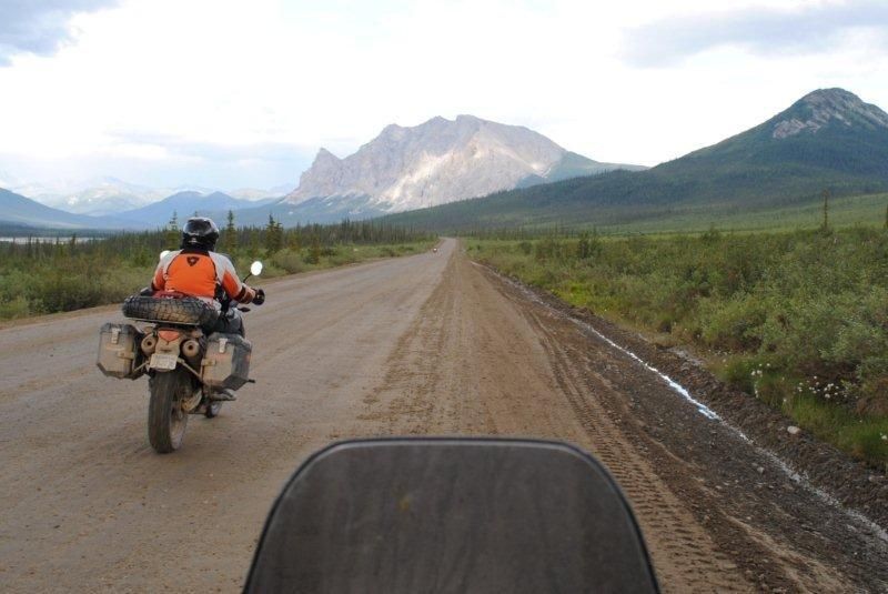 As I continued on, I could see Dave in my mirror shaking his head in disbelief. I could only imagine the profanities that were flying from Dave’s helmet as Kevin and I rode off and out of sight. I couldn’t help but wonder, what Dave was going to do as Kevin and I continued to ride north with no plans what so ever other than the goal to reach Prudhoe Bay. A few miles north I suddenly saw the distinctive sight of Dave’s lights flickering in the background as I rounded the next corner. At that point I realized Dave had thrown his well organized plan to the wind, in a trade for the fly by the seat of your pants adventure, which defines the “Sittner Plan”.
Kevin’s bold and risky decision to ride north turned a well planned trip into an exciting adventure filled with an uncertain outcome. The first thought that went through my mind was “were we going to have enough fuel to make it?” If we were lucky enough to make it, could we survive a freezing cold night in Grizzly and Polar Bear country? A well planned trip would have included extra fuel, food and a room at the oil fields to avoid a freezing cold night and a potentially hazardous outcome. Prudhoe Bay is the largest oil field in North America, located on the northern Slope of Alaska on the coast of the Arctic Ocean. The landscape is flat and entirely covered in permafrost, a condition where the soil about two feet down from the surface remains permanently frozen. The permafrost, combined with the flatness of the land, results in an abundance of small lakes and ponds because spring snow melt has nowhere to go. Wildlife in the area include; thousands of Caribou, Musk Ox, Grizzly Bears, Polar Bears and over 200 different bird and waterfowl species.
 Continuing on, the partly sunny skies gradually turned to dark clouds as the smell of rain filled the sky and before long we once again found ourselves riding in the rain. Eventually we reached the remote truck stop known as Coldfoot which is the last fuel stop for the next 240 miles. The reality we faced was an estimated 215-mile fuel range including the extra fuel we were carrying so, we searched the premises and found a plastic jug that would help us reach our goal. With no time to waste our journey continued on. A slow steady rain quickly increased causing the calcium chloride to liquefy into a slimy mess which added a challenge each time a speeding truck passed creating a wave of mud and rocks. After traveling hundreds of miles through spectacular scenery, we reached one of the most incredible sights of all as we approach Atigun Pass. Nestled among spectacular peaks in the remote Brooks Range is the highest of three major mountain crossings on the pipeline’s 800-mile journey across Alaska. The pass quickly climbs up and out of the tundra creating endless views of the Dalton Highway and the scenic Brooks Range. Reaching the halfway point, the dramatic scenery demanded my attention as I found myself at the edge of an amazing view. As I looked over the edge, I noticed Kevin and Dave had stopped in the middle of the road as a huge grizzly bear was approaching. Kevin and Dave were attempting to retrieve their cameras for a photo but by the time they retrieved their cameras the grizzly had closed the gap and was standing on his hind legs while taking in a huge snort. Kevin and Dave snapped a blurry photo and quickly sped off before the terrifying and awe-inspiring animal made another move.
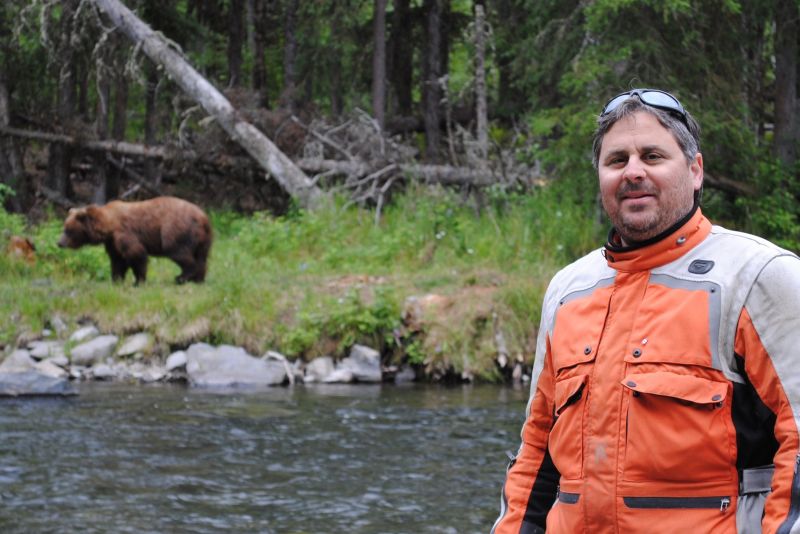 Our journey continued up the pass to the Continental Divide where we were humbled by the vastness of rugged mountains around us. After an exciting ride over the pass, our bikes began to sputter and run out of fuel so, it was time to pull over and gas-up. I climbed off my bike and suddenly noticed the extra plastic jug of fuel was gone! We had no idea where it had fallen off but with only 75-miles to go there was no way we were turning back and we were fully committed to the “Sittner Plan”. After squeezing every last drop of fuel from our reserve and no time to waste, our unplanned adventure continued north. Traveling across the tundra we were met head-on with a cold arctic blast while the temperature plummeted with every passing mile. As we approached a fog bank Dave’s bike began to sputter and suddenly shut off as he ran out of fuel. Kevin and I were also nearly out of fuel and we were now faced with a decision that could make or break our day of adventure. Our first option was to stick together and camp in the freezing cold in the middle of grizzly and polar bear country. Our second option was to take a risk and send one rider on with the hopes to return with extra fuel. Since Kevin had slightly more fuel in his reserve than I and we were on the “Sittner Plan” Kevin volunteered. So, with fingers crossed Kevin headed north and disappeared into the fog bank as Dave and I stayed together in the middle of nowhere.
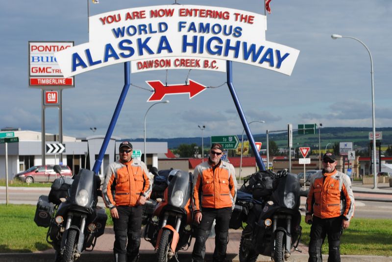 As the fog closed in all around us the temperature continued to plummet and the possibility of Kevin running out fuel became increasingly too real and our hopes to reach Prudhoe Bay began to slip away. Suddenly if out nowhere the sound of Kevin’s 990 Adventure broke the silence and before long we could see the flickering light through the dense fog. Dave and I were thrilled to see Kevin arrive with a canister of fuel and we wasted no time filling our bikes. Without hesitation we sped off through the icy fog with our quest to reach Prudhoe Bay. Our adventure continued north and before long we could see glowing lights in the fog from the small industrial town of Deadhorse. The mix of fog and glowing lights from the oil platforms created a strange and eerie sight, seemingly not from this world. As we approached this eerie sight we passed a herd of caribou that added another level of strangeness to this industrial town. As we enter the town I noticed there were no people, just a maze of heavy equipment, modular buildings and towering oil platforms in all directions. After wandering the gravel streets, we finally found the Prudhoe Bay Hotel which was surrounded by a convoy of large trucks. With no reservations and the hopes of getting a room, we entered the hotel which resembled a military barracks that was placed on a frozen planet. We asked if there were any rooms available and the answer was, “yes”. We were so relieved to know we had shelter from the frigid arctic cold that we were excited
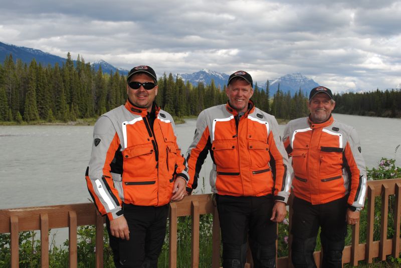 to pay a luxury fee for a military style room. After check-in we went straight to the mess-hall for a hardy dinner with the oil rig crew and ice road truckers. As we enjoyed our meal, we were genuinely thankful and amazed of how close we came to spending a freezing cold night in the middle of grizzly and polar bear country. We were also thankful to survive thousands of miles of adventure which included, risk taking, hazardous action, uncertain outcome and life-changing experiences, which are all the ingredients that define the “Sittner Plan”.
HUGE thanks goes out to all our “Sponsor” and REV’IT! Motorcycle gear which truly helped make the SNA Alaska / Canada Adventure a successful adventure!
Life is too short to confine your adventures to well-worn paths. By, Mark Girardi
Event Details:
Multi-Day Tour: (15 to 20 riders with 20 riders max)
This ride is DESIGNED for lightweight, middleweight to heavyweight ADVENTURE motorcycles.
OFF-ROAD terrain is rated as easy, mild, moderate, and some moderately-challenging.
Ride distance approx. 7,500 miles round trip (2,500 miles dirt roads)
Gas stops (250-mile range required)
MEETING TIME: 8:00 a.m. (ride starts at 8:30 a.m.)
MEETING LOCATION: Blaine, WA. TBD
MEALS (Meals not included)
Breakfast, lunch, and dinner at restaurants.
Bring water and snacks.
HOTEL RECOMMENDATIONS: (Hotel not included)
Riders are responsible for booking their hotel reservations.
OPTIONAL CAMPING: (Camping not included)
Recommended to make camping reservations in advance.
OPTIONAL: Looking to split hotels or carpool?
Email info@SierraNevadaAdventures.com
NOTE:
Book your hotel reservations as soon as possible to secure availability and the best rate.
Call your hotel to make arrangements to leave your truck/trailer if you plan on trucking/trailering.
The motorcycle ride begins in Blaine, WA., and returns to Blaine, WA., approx. 4 pm on day six.
National Park and State Park entry fees (Not included)
QUESTIONS: email info@SierraNevadaAdventures.com
.JPG)
.JPG)
.JPG)
.JPG)
.JPG)
.JPG)
.JPG)
.JPG)
.JPG)
.JPG)
.JPG)
.JPG)
.JPG)
.JPG)
.JPG)
.JPG)
.JPG)
.JPG)
.JPG)
.JPG)
.JPG)
.JPG)
.JPG)
Still Have Questions?