


Sierra Nevada Adventures Single Day Rides
Crystal Basin CA-BDR Ride 1-Day
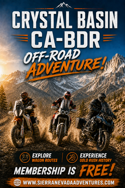 CRYSTAL BASIN CA-BDR RIDE (1-Day Ride)
The Crystal Basin CA-BDR Ride is a true Sierra Backcountry Experience with the perfect mix of OFF-ROAD and remote mountain roads through deep forest and rugged alpine scenery. The Crystal Basin ride EXPLORES the CA-BDR section from the remote Cosumnes River drainage with the Crystal Basin area, tucked between the South Fork of the American River and the southern rim of the Rubicon drainage — three iconic watersheds that carve deep, rugged terrain on the western slope of the Sierra Nevada. Once you’re off the pavement, the forest roads and off-road routes wind through dense pines, granite slabs, and high-country lakes that feel worlds away from the busy Highway 50 corridor, to provide a truly amazing adventure!
Off-Road terrain is rated Mild-to-Moderate, Off‑Roading With Big Payoff. This part of the CABDR isn’t about punishing rock gardens or extreme obstacles — it’s about flowy forest routes, scenic ridgelines, and the occasional technical section that keeps things interesting. Perfect for riders who want adventure without the stress of the rocky Rubicon proper.
Route provides Hidden Corners & Points of Interest: A customized route through Crystal Basin means you get access to the lesser‑known spots:
• Remote overlooks toward the Crystal Range
• Quiet lakes tucked behind granite ridges
• Old fire lookouts and historic sites
• Spur trails that reward exploration without requiring hardcore riding.
It’s the kind of area where you can spend a whole day wandering and still feel like you’ve only scratched the surface.
The Vibe is a classic Sierra Nevada backcountry: crisp air, towering granite peaks, and that sense of freedom you only get when the road turns to dirt, and the forest closes in. It’s adventurous without being punishing — the sweet spot for a memorable off‑road adventure!
Your adventure ride begins on the edge of the foothills on the western side of the Sierra Nevada. You will have the opportunity to travel a great combination of back roads and explore a series of remote dirt roads through the historic Gold Country to the wild scenic Crystal Basin located on the western slope of Desolation Wilderness. Your off-road adventure explores deep canyons, shady, dense forests, and cascading creeks, leading to crystal-clear blue lakes with stunning views of the Crystal Range. After exploring off-road, you will have the opportunity to ride a scenic single-lane road through shady dense forest to a remote fire lookout which provides a spectacular panoramic view of the scenic Crystal Range in the Sierra Nevada. The mountain summit is your destination for lunch and taking in the panoramic view of the majestic Crystal Range. “Don’t forget your camera”. After your visit to the scenic lookout, you will explore a combination of curvy twisty roads and fun dirt roads on a completely different route back to your original start point located on the western edge of the Sierra Nevada.
 The Crystal Basin located on the western slope of the Crystal Range spans roughly 85,000 acres in El Dorado National Forest, which simply means it’s your public land to explore. The Crystal Basin is filled with beautiful scenery consisting of lakes, reservoirs, forests, streams, waterfalls, and stunning views of the Crystal Range. Historically speaking, the El Dorado National Forest region was originally home to Miwok, Maidu, and Washoe tribes before pioneers explored the area in search of “gold” in California. The name El Dorado is Spanish for the golden one and later became the name of a legendary “Lost City of Gold” that has fascinated and so far, eluded explorers since the days of the Spanish Conquistadors. For those who know Spanish, it’s obvious that the name of the forest is not the common spelling for El Dorado. The historical reason for this unusual spelling is not clear in the records. Some say it was a typo, other’s say it has a Chilean root that came with the early gold miners. Regardless of how it is spelled, it has been spelled that way for over 100 years, long enough to be part of the national forest’s distinct heritage. The El Dorado National Forest created on July 28, 1910, was carved out of the existing Tahoe National Forest to the north and Stanislaus National Forest located to the south. The story of today’s national forest is written on its wild landscapes and in the hearts and spirits of people who seek adventure.
 The Crystal Range is a majestic small chain of mountain peaks located in Desolation Wilderness in the state of California. This impressive range is a subrange of the Sierra Nevada Mountains, located west of Lake Tahoe and east of the Crystal Basin. The Crystal Range mountains run roughly 25 miles north-to-south. The highest and most southerly peak is Pyramid Peak (9,985 ft.), Mount Agassiz is next to the north at (9,967 ft.), with Mount Price at (9,975 ft.) rounding out the southern group of peaks. North of Mount Price is Red Peak, Silver Peak, and Tells Peak which is the northernmost named peak in the range. The impressive Crystal Range is part of the massive Sierra batholith, the combined masses of granitic rock that have been uplifted by tectonic action to form the 400-mile-long Sierra Nevada. Around Lake Tahoe, the peaks are in the 10,000-foot range with Freel Peak being the highest peak at (10,886 ft.). The Sierra Nevada, John Muir's "Range of Light", is perhaps the most beautiful single range in the contiguous United States, as well as the highest and longest. The Rockies may be technically longer but do not have the unified and continuous mass the Sierra Nevada presents. On shaded relief maps, the huge elongate mass of the Sierra Nevada, rising from the flat Central Valley on the west and the deserts
  of the Great Basin on the east, stands out strikingly as a truly enormous and important mountain grouping. Even though Colorado has 54 peaks over 14,000 feet to the 12 in the Sierra Nevada and only Mount Whitney rises higher than the highest summits in the Rockies, the massive Mount Whitney at (14,505 ft.) holds the record for the highest mountain in the contiguous United States and the Sierra Nevada.
The Crystal Basin holds a rich history. Once the home of the Miwok, Washoe, and Maidu people, it later became the home to Italian Swiss dairymen and the grazing ground for cattle during the 1800s. In the early 1900s, the USDA Forest Service opened the Crystal Basin to the public. In 1957, the Sacramento Municipal Utility District (SMUD) embarked on the Upper American River Project (UARP), a series of hydroelectric power plants. Today, the UARP generates a staggering 1.8 billion kilowatt-hours of clean, affordable electricity annually, enough to power approximately 200,000 homes in Sacramento. As part of the project, SMUD created a network of picturesque mountain reservoirs and recreational facilities, continuing to provide diverse land and water-based recreation opportunities for forest visitors.
The Crystal Basin Recreation Area of the Eldorado National Forest, an 85,000-acre expanse of pristine pine and fir forests married with the western slopes of the granite of the Sierra Nevada. This region is graced by the grandeur of the Crystal Range’s majestic granite peaks and is laced with serene lakes, reservoirs, and pristine streams. Throughout the four seasons, the Crystal Basin unfolds a diverse landscape for rugged outdoor activities for those who seek adventures.
Event Details:
Single-Day Tour: (15 to 20 riders with a max of 20 riders)
This adventure ride is DESIGNED for lightweight, middleweight, and heavyweight ADVENTURE motorcycles.
Off-road two-track terrain is rated easy, mild, moderate, and moderately challenging.
Ride distance approx. 200 miles round trip (75 miles dirt roads)
Gas stops (125-mile range required)
MEETING TIME: 8:30 a.m. (ride starts at 9:00 a.m.)
MEETING LOCATION: Placerville, CA.
Caltrans Missouri Flat Road Park & Ride
6837 Mother Lode Dr, Placerville, CA 95667
Arrive in the morning with a full tank of gas.
The ride returns to Placerville, CA. (approx. 5:00 p.m.)
MEALS (Meals not included)
Bring water, snacks, and lunch.
OPTIONAL HOTEL Before Event: (Hotel not included)
Riders are responsible for booking their hotel reservations.
-Best Western Plus Placerville Inn 6850 Green Leaf Dr, Placerville, CA 95667
Truck/trailer your bike? Parking is available at the meeting location.
QUESTIONS; email info@SierraNevadaAdventures.com


.jpg)
.jpg)


.jpg)

.jpg)

.jpg)
.jpg)
Still Have Questions?